Showing posts sorted by relevance for query cow creek. Sort by date Show all posts

Sunday, March 8, 2015

Crossing Washington On The JWPT - Cow Creek Revisit

I had an amazing bike/social experience yesterday, and I'm positive that I don't have the literary skills to adequately describe it, so I will just have to do my best, and you will just have to live with it.

The genesis of this adventure (and yes, it is without question the March BikeEVENTure), was the disastrous Day 2 of my tour across the our great state on the John Wayne Pioneer Trail almost three years ago now.  I've needed to get back out to the Cow Creek area ever since, to finish unfinished business.  All the official maps mark this area as "closed", and optimist that I am, I've always assumed there was a way to forge through this area, although that particular, desperate Day 2 of my tour was clearly not the right time to experiment.

My partner in crime this day was Chip, and our goal was to explore the Cow Creek section of the JWPT, and figure out if there was any possibility of riding through this section, as opposed to the stupid-long detour options.  It seemed like a reasonable enough question.  Holy hell, were we in for an education.

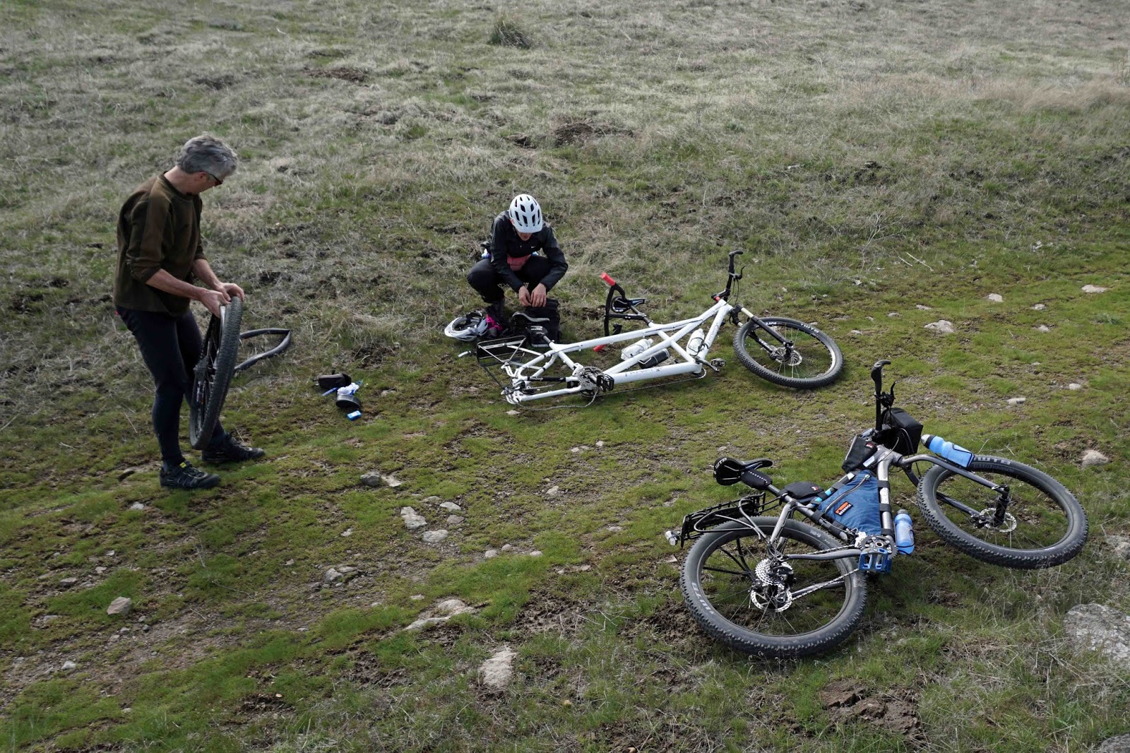
We parked at Ralston, and headed out from there.  We'd ride about 6 miles to get to Cow Creek.  Just a couple of miles in, I had a goathead-induced flat.  Multiple punctures.  Ugg.  If goatheads were going to play any kind of a role in this day, it would be a short one, because neither of us were prepared with sealant, which is really the only way to deal with these bastards.

After a lengthy delay, we were rolling again.  This would be the last flat of the day.  Yay.  Fat flats are the worst.

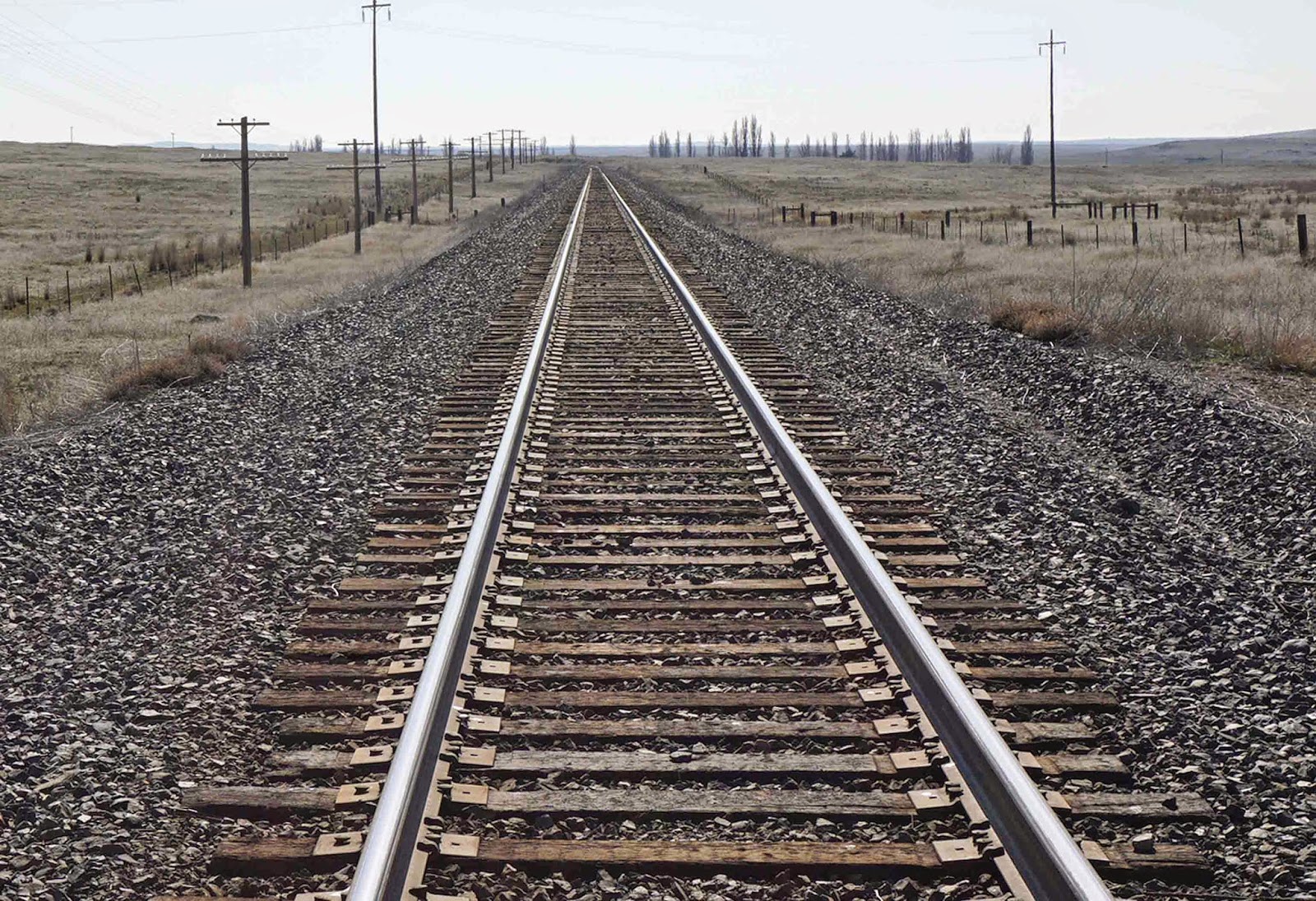
 The visual rail history along the JWPT is just awesome and cannot be ignored.

Photo: Chip
 And then, there are the cows.  They don't call it Cow Creek for nothin'.

I am filthy sick these days, over my desire and willingness to get on the road with my truck and burn a bunch of time and fossil fuel in order to seek out quality riding experiences.  It's pretty inexcusable, but this maybe kind of explains the fix that I am a slave to:

Me, in all my bad-assedness.  Photo: Chip
 All the fun ends (or begins, depending upon your point of view) abruptly at Cow Creek.

Photo: Chip

The summary explanation:

There was obviously one mother of a trestle that spanned Cow Creek.  Since it's long gone, the question before us was how to traverse the valley without it.  It certainly wasn't straight over the edge.

But if we could find a way down to the main road paralleling the creek, there was that lovely bridge that would take us across and reconnect us with the JWPT.

After quite a while searching the cliff for ways down, we finally came across this ledge that enable a sketchy huck-a-bike passage.  Were we technically trespassing on private land?  Yes, but we were just kind of flying under that radar and sticking as close as possible to the public access corridor, and were we really doing any harm?  (Hold that thought.)


We did not set out on this day with the intent to trespass; on the contrary, it was our objective to explore the area via public access means.  At the bottom of the cliff, we set out on what I assumed to be a county road route, with the intention of arriving at Marengo, a town in name only, and then looping back on the JWPT and bushwhacking/hike-a-biking our way across the Cow Creek valley, and returning to Ralston on the same section of the JWPT that we had ridden out on.

My camera skills were woefully inadequate in terms of capturing this next man/animal exchange, but it has long been my experience and contention that horses dig bikes and we were approaching a couple of fiesty dudes who were obviously looking to add some excitement to their day.  Whereas cows are nervous and care only about keeping a safe distance, these fellas were looking to mix it up.  Great spirit, these guys.

Like I said, I failed bigtime at capturing the brief encounter on camera, but there were two of them and they want to play, and when you have an animal that big that is closely following you down the road in a gallop, you are nerrrr . . . vousss.  I told him to "stop", which he did, and which probably hurt his feelings.  Dumbass guy on a bike who hates fun.

All up on the day, we saw 4-5 horses, 1 coyote, 1 rabbit, and 1,378 cows.

Lots of calves, this time of year.

 Of all the cows we met on this day though, these four were out standing in their field:

 I'm not sure if I mentioned it yet, but the Blackborow is really growing on me.

Eventually we crossed the live rail line and this view was kind of a horrific reminder of the pain that we experienced on our hot and windy detour those three years ago:

Turning the other direction, though, as luck of timing would have it, a train was coming through, and that is always cause for joy and happiness and the erasure of bad memories, and of course, photo ops.

Marengo, our reconnection point with the JWPT, and brief lunch stop.  I am not sure if I have mentioned yet how much I like this bike, but I really like this bike.  Notice the glorious rays, for instance.


The scenery between Marengo and Cow Creek was typical JWPT awesome.

Here's the view of Cow Creek from the Marengo side.  That's the road that parallels Cow Creek on the other side.  (Hold that thought.)

The plunge over the edge is just as dramatic and impassable as on the other side.

The option to pass resided in the private land directly adjacent to the trail.  Would we be technically trespassing on private land?  Yes, but we would hopefully be flying under that radar and sticking as close as possible to the public access corridor, and were we really doing any harm?  (Hold that thought.)

The trip down was a bit rigorous, but workable.


I don't have any photos of what happened next, but as we were picking our way down the steep embankment, we saw an ORV cruising down the road on the other side of the creek and then watched it stop.  I don't know the subtleties of these machines, but it was generally of this type:


It sat there and we knew it was watching us.  This is really desolate country, and there is no reason it would have stopped, except to watch us.  And of course, the knots were developing in our stomachs.

It watched and watched, as we slow-poked our way over the rocks and down into the valley bottom.  And as we approached, it started moving towards us.  I stopped, just as we were entering the valley floor, and Chip followed my lead.  A respectful gesture to the approaching vehicle.  We were in between those rows of column footings, and therefore on public land at at that point, I believe.

The gentleman that was driving and his (I assume) wife were in the vehicle, along with their dog.  He had his rifle prominently displayed.  We exchanged greetings, and he identified himself as the owner of the land adjacent to the trail, after which the conversation shifted to what we were doing there and the fact that they'd watched us trespass our way down the embankment on the Marengo side, and questioned us about how were going to proceed from here, which basically exposed our intention to trespass our way up the bank on the other side, en route back to Ralston.

We didn't ask him his name and he didn't ask ours, but he made it clear that he was in total control of the situation and the outcome.  How could it be otherwise?  We were a couple of city slickers out on a Saturday, looking for some adventure, and trampling all over his personal property.  Was he being kind of anal about it?  Yes, by his own admission.  But that's his right.  While somewhat tense, at no time did the conversation become outright confrontational or adversarial, but there was absolutely zero doubt about who was in control.

Chip politely asked for permission to "trespass our way out".  There was no immediate answer.

The Owner asked if we had a permit to use the trail.  Shit.  No.  Busted again.  I know that a permit is required to use the trail, but this excursion was spur of the moment, and I'd decided to wing it.  Shit.

I did tell him that I'd ridden across the state on the JWPT and that I'd endured a pretty horrific detour around Cow Creek and had always wanted to get back out here and check it out, and thus this day ride.  That seemed to be pretty effective in terms of communicating what Chip and I were about, and not, and what we were doing out here, and what we weren't doing out here.  I totally LOVE the JWPT and I think/hope that maybe a little of this came across in the exchange, because he told us the story of how the trestle was removed, which was fascinating, and also talked to us at length about rattlesnakes, which was equally as fascinating.

In the end, he allowed us to pass back across his property, and then headed out on his ORV.  I cannot be anything other than grateful to him for taking the time to figure out who we were and what we were up to, and passing reasonable judgement.  At the same time, he made it clear that we were out of line.  Which we fully acknowledge.

Prior to this trip, I'd envisioned Cow Creek as some sort of swampy wasteland.  I naively assumed that this is why that section of the trail is closed.  Cow Creek is actually the opposite:  A lovely parcel that is owned by a passionate guy . . .


We, in the city, I think, tend to view the JWPT as a public right of way, a thorofare through who-knows-what, and who cares.  Those folks that own property across which the trail passes view it with a much different perspective, and I am really humbled to have been provided with some quite impactful insight.

Yep, that's the same rancher's track hoe, broken down in the middle of the trail.
So what's the overall takeaway?

Well first, the complexity of the relationship between the state and private landowners.  Holy hell, the folks that live in these remote areas are strong-willed.  But: They do work that not many of us would want to do, in terms of managing food resources.  Every day, In whatever harsh conditions reside.  Winter, summer.  Day, night.

As far as would I ever want to back to Cow Creek, the answer is not only no, but hell no.  It was cool to see, but that was an extremely uncomfortable encounter that has been this dark cloud in both my waking and sleeping moments ever since, and I get that it was my fault for instigating it, but OTOH, our actions and intentions were not all that horrible, and I would never willingly put myself into that same situation of being that vulnerable/powerless to that kind of control/power again.

But not that I wouldn't take the same kind of risk in the same kind of different situation, where I felt like I was trying to be respectful of the public-private boundary.  I just don't think my position is all that unreasonable, but of course, I may be way out of touch.

As far as how I would advise myself or anyone else who wants to through-travel this area as part of a JWPT tour, I can't in any good conscience advise you to do anything other than skirt the area on the state-advised northerly detour.  The southern detour routes are maybe a viable option, dependent upon your adversity to the same type of risk described herein.  I wouldn't recommend passing directly through Cow Creek, under any circumstances.

Saturday, June 30, 2012

Crossing Washington On The JWPT - Day 2

The plan for Day 2 was to ride another 50 miles, from about mile 65 on the map below to about mile 115. What distinguished this day's route was its remoteness - no towns, no known water sources . . . nothing but harsh, rocky landscape until maybe, if we were able to log the miles, we would reach the town of Lind, towards day's end. If that were to happen, there was a bar and grill there, at which a beer and a burger might be available. Never in the history of the world has a more worthy goal existed. After dinner, we would pedal 10 or so miles out past Lind and find our spot for the night.


What actually happened was that despite a tremendous amount of work, we pedaled a mere 35 total miles and covered just 22 miles of the actual JWPT.  The green line running from east-to-west on the map below is the JWPT and the orange path over it is our 22 miles of actual progress. The orange off-trail loop to the south is a detour we took around a section of the trail known as Cow Creek. (The vertical green line, BTW, is the Columbia Plateau Trail, another abandoned railbed that subtly beckons me and will probably host another of my excursions at some point.)

Here's how the day went down . . .

The previous night we'd been in a bit of a hurry to find a place to pitch camp, because it looked as if a storm was rolling in, and pretty quickly. The storm never really materialized, but it was obvious that something was changing, weather-wise. Clear skies greeted us on the morning of Day 2, along with a breeze.   It was coming at us from the west, but hey, who doesn't love a breeze? We were one with nature! Embrace the elements! What's not to love???

That trestle in the distance is the Columbia Plateau Trail.

For me, a significant part of the allure of riding the abandoned Milwaukee Road is at least a mild fascination with railroads in general.  One of the things that was a surprise to me is how intertwined the dead and active rail lines were out here in no-man's land. On multiple occasions while riding our ghost rails, we'd be watching and listening to living trains on one side or the other. It was a pretty badass sensation.


The pictures I've posted so far don't really do justice to the surface of the eastern-portion of the JWPT, but we'd been getting bounced and shaken around pretty hard over the last day-and-a-half and now it was getting serious. It was also starting to feel pretty damned forsaken. And did I mention that the breeze had turned into what one might call wind.


As if on cue, images of death began to appear. This poor fella was lying right in the middle of the trail. A not-so-subtle reminder to us city-dwelling would-be adventurers that this wasn't a game. He was sustaining a whole eco-system of flies and maggots, so his death was not in vain. And in some way, it was a consolation to know that there was no longer the possibility of ending up on the business end of those gnarly fangs.


. . . or have to worry about a shredding from those claws. Which had been widely separated from the body. No man's land, man. I'm here to tell ya.


I'm a hundred percent sure I would never have noticed this if we hadn't chanced to take a rest stop right next to it. Even then, I almost didn't. It's a deliberately-formed pile of rocks with some fading fluorescent orange spray paint scrawling on the side.  I didn't capture the text very well with this shot . . .


. . . but if I Photoshop the light way down it's a little more visible. If you still can't quite make out the text, it's 'RIP'. So yeah, a grave, right off the side of the trail. Seriously eerie. I spent a long time while there and as we pedaled on down the trail, and even now, thinking about it. Somebody went to a hell of a lot of effort to bury something there, in order to protect it's body/carcass from becoming a free-for-all to the animals in the vicinity. It wasn't big enough to be the grave of a horse. And the only other creatures I can think of that would fit this amount of effort and size of grave would be a person or a large dog. And while it's possible, it's hard for me to think about a person being buried this way, in this day and age. Not that it would be particularly bad, but just that I think that it's unlikely. Maybe though. I guess I choose to believe it's a dog, whose best human friend wanted him to have a place where he could look out over the fields where he once helped tend to the cattle. It's a more convenient and comfortable conclusion for me that way.


In direct contrast to this somberness, the beauty of the wildflowers couldn't be contained.


Meanwhile, the road seemed to be getting rougher. And the wind was getting windier.


There's a section here that isn't supported by photos. I'm having a hard time believing it myself, as I've become such a PITA shutterbug. But I guess things were getting kind of serious in terms of our situation and I must have been pretty occupied by it. So I'll just describe this next part then, until the pictures pick up again.

We were getting kind of, but not anywhere near desperately, low on water. And we were approaching a section of the trail known as Cow Creek. Cow Creek is marked on the maps that the state sent me with my permits as 'impassible'. I'd done the recon on most sections of the eastern portion that I thought I needed to know about to make the trip a success, but somehow Cow Creek had eluded my consciousness, slipped off my radar. Eric, however, had ridden through it in August of last year, from west to east, and was telling us that it was quite a bushwhack. He suspected that in June, it might be pretty swampy, and therefore even more work. I've been embarrassed to tell you this until now, but my bike and gear weighed 100 lbs (yes, I know it's obscene, but it's fact), and Scott was towing a trailer that was a bit of a challenge through the rough stuff, and Eric was thinking that the decision to plow through Cow Creek may not be the best one. Scott and I were listening.

We were at the crossroads of our decision to continue on the trail or bail out and try to detour on roads at the town (?) of Marengo (nothing there except a grain elevator . . . no houses, no faucet, we looked). It's a surreal memory for me though, because at Morengo, the JWPT and the active Union Pacific line converge and the train that you saw a few pictures back was stopped there, presumably to wait for another train down the line to get off on a siding, and it was just sitting there, watching us make our decision. It was getting seriously windy at this point, so it took some commitment to fight our way down a path we weren't sure of, but we decided to get off the trail and try a road that showed promise. A mile or so down this road and we realized it was gonna dead end. Damnit.  Back to Morengo.

Another road led out of "town". To our credit, we were ever the optimists and followed it. Was it ever a beautiful, smooth road. But was it ever looking more and more like it was turning from a somewhat public road into a somewhat private road that led into a ranch and faded into a field. Maybe it went on and remained a road that would lead us on our detour, or maybe not, which meant more backtracking. 'No Trespassing' signs abounded. Our water was getting pretty low. Lovely. We stopped there for a long time and deliberated over our options. The two different maps I had didn't show enough detail to help. Neither did my GPS. Risk is not a bad thing, but going forward seemed to contain just a bit too much of a not bad thing.

We could always get back on the JWPT and take our chances at bushwhacking our way through Cow Creek, but it had gotten windy as hell and we'd expended a lot of energy and time on trying to figure out a detour and did I mention our water was getting low. What our maps did show was that the active Union Pacific line would lead us to roads we could identify on our maps and which would lead us back to intersection with the trail, at the tiny town of Ralston, on the other side of Cow Creek.

With 20-20 hindsight, I'm not sure it was the right decision. "Riding the rails" seems like a swell idea, until you actually try it. It's brutal, and after a few hundred yards of experimenting with riding down the center, riding to the right, riding to the left, we all pretty much resigned ourselves to walking our bikes down the tracks. For 3-1/2 miles. Longest damn walk of my life.

And I'm sure that there are many places in the country where there is no such thing as shade, but for us Spokane-dwellers, it's a given and suddenly we were in an environment where there was none to be found. Oh wait, sorry, there was an occasional rock cut where you could lean against one hot wall and get part of your body out of the sun. Did I mention that it was one windy bastard of a day and that my water supply was almost exhausted, and that I was so freaking elated that I had chosen to spend my vacation this way.


Our live rail journey finally, mercifully, ended, only to dump us onto a paved road that would climb for the next 2-1/2 miles, straight into the bitch of a windstorm that had developed. No one in the history of the universe has ever ridden a bike more slowly than I rode my bike up that hill. Flipping you the bird, mother nature.

Eric was leading the way, and then Scott, with me and my hundred pound turd bringing up the rear.  At the top of the hill, was the only tree within a thousand mile radius.


Not a word was spoken. Instinct took over. Eric pulled off. Then Scott. I was only too happy to follow suit. It was a spontaneous kindergarten-style group nap in the dirt under that tree, with the wind beating the hell out of us all the while. We were burnt toast.
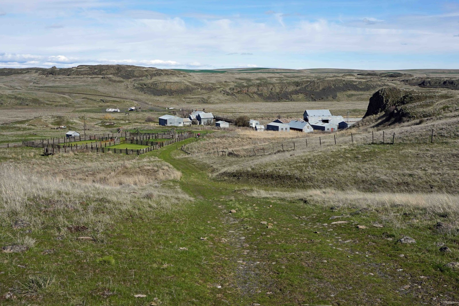

The realization that we weren't gonna reach our planned destination had set in hours ago; we were more focused on figuring out a way to use what little energy we had left to get to a place where we could hunker down. Fortunately, Eric had toured through these parts at some point and remembered that there was a small memorial park in the tiny town of Ralston. Our new destination then, about 5 or 6 miles away. But Eric and I had fully depleted our water supplies - bone dry. And then miraculously Scott pulled out a full half-gallon bottle of good, clean, energizing Spokane water that he'd been hauling in his BoB. He filled our bottles and all manner of hope was restored.

It seemed like it took one hell of a long time to get there and I guess I will never forget the last stretch, which was several hundred yards on a flat smooth dirt road. Eric was in front of me and I would watch the gusts of wind and dust twist and surge down the road towards him and then hit him and almost knock him off his bike, and then continue down the road toward me, where they would force me sideways to keep my balance. I vowed to keep my speed at 5 mph, but lost my battle of wills with the wind when my speedometer showed 4.8.

When we finally arrived, it was such an oasis. A mirage, maybe  There is no such thing as grass in these parts, no such thing as trees that break the wind.


And certainly no such thing as cold, clear water that runs from the ground!


There was no euphoria, no celebration of any kind that we had made it. We just existed there. Fried eggs were we. Mostly feeling like total crap and  too wasted to eat, I was just about trying to rehydrate and recuperate. We were zombies, just doing what we had to do to ride out the windstorm. Camping there was probably not permitted, but we had no option and we were so grateful for this place. If anyone had confronted us, we'd have just told them that we didn't plan to be there but that we honestly didn't have any other choice, and hoped for their understanding.
 

Despite everything that had happened during Day 2, or maybe because of it, what was most profound to me was that we were taking refuge in a park that existed due to the ultimate sacrifice of some guys who had been raised in and around this tiny town. As I read the memorials, nothing that we had done that day seemed very hard, or worthy of note even, and at once I felt very honored and privileged and grateful to be staying in this place.


Day 2 Ride Stats
35 miles
6:14 saddle time
5.5 mph avg
16.1 mph max
105 total trip miles

Saturday, March 19, 2011

Working The Plan

Next year (2012), I turn 50. For the last two or three months, I've been kicking around ideas for a bikey "event" to mark the milestone. I want it to be something fairly epic and hopefully very special - something that will be a worthy celebration of the first half century of my life and create the kind of memories that I will want to dwell in when I am eventually senile. And because of that, I'm starting the planning now. What I have in mind is not something I can just throw together a coupla months in advance.

The planning phase I'm in right now I guess would still technically be considered brainstorming, in which I'm allowing myself all kinds of freedom to consider vastly different versions of this "event".  But I've become captivated enough by one particular idea that I've gone down the path far enough to start intersecting with the crossroads of reality.  And that idea is a week-long, fat bike, cross-state tour on the John Wayne Pioneer Trail, which is the railbed of the former Chicago, Milwaukee, St. Paul and Pacific Railroad.

I've been aware of this trail for a while now, and while I'd heard bits and pieces about different sections, I didn't know very much about it in terms of it's viability as a cross-state bike tour route.  I'd known that much of it is remote and desolate, and that was part of the appeal.  It would be cool to have a riding partner to experience this trip with, but Patty made it immediately clear that it sure as hell wasn't gonna be her, and it's pretty unlikely, given the type of trip and the time and equipment requirements, that anyone else would emerge.  But I was also okay with the thought of going solo - you know, time alone in the middle of nowhere, to ponder where you've been the past 50 and where you're headed, amidst the man against nature backdrop, all that kinda krap.  I joke, but I'm serious.  A half-century retreat.  So I had created a tough, challenging and yet rather romantic version of it in my head.

Over the past weeks, I've been doing online research as time allows.  I ordered a beat-up copy of the book "Washington's Rail Trails" by Fred Wert, for $2.87 on Amazon.  Little by little, I've been piecing together a little more accurate and real picture. And then I hit the mother lode -  a review on this page at TrailLink.com  from user 'Beloh' who rode pretty much the entire route, from west to east, in October of last year:

We rode this trail (on mountain bikes with BoB trailers) starting in Seattle by by riding the Burke-Gilman Trail to the Sammish River Trail to the Tolt Pipeline Trail to the Snoqualmie Valley Trail which connects to the John Wayne trail/Iron Horse State Park. The 1st day was 70 miles to the Alice Creek backcountry campground. The 2nd day went as far as Cle Elum, and the 3rd day went to Wanupum State Park on the Columbia. The old rail road trestle across the Columbia is gated off so we then crossed on the I-90 bridge at Vantage WA (VERY DANGEROUS) and picked up the trail at Beverly, WA ending day 4 in Othello, WA. Day 5 was from Othello to Ritzville and Day 6 was Ritzville to Lamont, WA.

I would have given this trail a higher rating but, because of tunnel closures, there are some long detours required. The 1st is a steep, miserable climb up to Snoqualmie Pass on I-90: there is a wide shoulder but it is busy and noisy and climbs 700' in about 2 miles. You can rejoin the trail at Hyak for a few miles but you get sent back to I-90 near Cabin Creek and ride it all the way to Lake Easton State Park. The trail, when you can get on it is good, mostly gravel. Also, after you leave the Snoqualmie Pass area there are no places to camp except at Wanupum State Park and an ORV park near Beverly, even hotels get scarce. This makes for some long days.

The trail officially begins at Rattle Snake Lake near North Bend, WA. It is in good condition, gravel and dirt, and climbs steadily all the way to Snoqualmie Pass. There are 2 nice state park campsites at Alice Creek and Carter Creek ($5/night, vault toilets, no water but streams are nearby.) Unfortunately, the tunnel at Snoqualmie Pass is closed so riding I-90 is the only way over. There are a couple more campsites along Kecheelus Lake, east of the Pass

After Cle Elum, more signs try to direct you to another long road ride (but not on I-90 this time) but the tunnels are open so don't take the detour. This section is along the Yakima river and is probably the prettiest section of the ride, well worth a day trip.

The next detour is after Ellensburg at Kittitas around a derelict trestle. This is about 3 miles with some climbing but the roads are lightly traveled. This ends at the Yakima Army Base where you self register to ride across. (Just the idea of riding through a military firing range is too cool.) The trail on the west side of the Boylston Tunnel is very soft with lots of horse traffic so the riding is slow. The tunnel itself is open although the army has recently put in some concrete barriers to keep vehicles out of it. East of the tunnel you begin a fantastic 15 mile descent to the Columbia River. The trail is still soft but not as bad as on the west side because of fewer horses.

Camping at Wanupum State Park was decent but expensive ($28 - no hiker/biker sites.) The next morning we crossed the I-90 bridge at Vantage, probably the most dangerous part of the ride. The bridge is 2 lanes each direction and absolutely no shoulder. Traffic was light and the cars/trucks gave us plenty of room but it is uphill for 1/2 mile; a bad place to get a flat. Unfortunately there is no other way across. After this it is an easy ride to Beverly to rejoin the trail.

The rest of this trail requires you to get permits in advance. Depending on which section you plan to ride you get them from either WA State DNR or WA State Parks. They will also send you info on closed sections and detour routes. Be sure to ask for gate lock combinations.

Next you get about 14 miles on beautiful trail, including unexpected crossings of Lower Crab Creek. Right before you go back on the road you ride through the tiny town (no services) of Smyrna. This section is filled with goat-head thorns. If you don't know about these thorns do some research and plan accordingly; Slime tubes don't even slow them down. Also watch out for electric fences (but that's another story.) Once you've fixed you're flat tires it is an easy, but long road ride into Othello.

After Othello there is another 10 miles on road to Warden, WA where you pick up the trail again. The trail starts getting rougher here, with larger ballast so the going is slow. The is no water along this section so fill up at Warden. It is a long ride to Lind WA where another trestle is out. We left the trail and rode US 395 to Ritzville because it was getting dark. The trail continues after Lind for another 15 miles and then you detour to Ritzville (10 miles) to avoid a missing bridge over Cow Creek.

Leaving Ritzville you ride the roads for about 10 miles to get back on the trail. Even rougher conditions now, big tires and low pressure are the only way to get by. We rode as far as the Columbia Plateau Trail and headed north to our pickup point in Lamont, WA.
The parts of the trail in Eastern WA are fairly isolated so be prepared to get yourself out of any trouble you get into. We encountered no other trail users after Ellensburg and cell phone coverage is spotty. Water is scarce, bring a filter and/or treatment tablets; you'll be drinking from streams in cow country. Even in late September then sun was hot and there was minimal shade. Rattle snakes are around and those goat-head thorns will ruin your day.

I was initially crushed.  All the closed tunnels, all the missing trestles.  I-90 detours.  Blech.  Reconciling your dreams with reality can be a total bitch.

And so I pretty much wrote it off, but not totally, and as the days have progressed, I've re-aligned my expectations a bit.  Which I suppose might be the key to enjoying this trip.  Maybe all the detours are just part of the bigger challenge.  Maybe I just really wanna do it, no matter what, and I'm just going through the head games necessary to do get there.  Not sure.  Pictures like these constantly haunt me, though.

What I do know is that I'm still motivated to spend time doing research, and that I'm really enjoying it.  This is an old WA road map that's been sacrified to the cause.  The blue line is the route from the ID-WA state line near Tekoa to the intersection of the Columbia River at Beverly . . .


This Gazette has been a tremendous resource as it shows the actual route as a dotted line, and in a very detailed scale.  Which I have subsequently traced with the blue highliter to make it look like a river.  If I go, no matter what high-tech navigational aids I have along, these pages are getting ripped out and coming along . . .


Time will tell. If I do move forward with this plan, I'll need a fat bike this year, in order to allow myself some time to get going on the equipment end of things and pre-ride some of the different sections.  And to figure out things like how to steer clear of rattlesnakes and what to do if I was to actually get bit out in the middle of nowhere, by myself.

Other ideas include:
  • a multi-day tour through the Idaho Panhandle National Forest
  • a trip with my bike to Portland via Amtrak followed by a couple of days banging around in that bike-friendly city, followed by a tour home along an interesting route
  • a multi-mode (bus, train, plane, bike) multi-town/city tour with a folder
These seem a bit pale in comparison to the JWT X-WA idea.  At the moment.

Saturday, March 26, 2016

Exploring Escure Ranch And A JWPT Detour

Today was an all day road trip with friends Chip and Pat that served a couple of purposes:
  1. Explore some of the BLM-managed Rock Creek/Escure Ranch Recreation Area
  2. Scout a detour for a newly-closed portion of the John Wayne Pioneer Trail
Rock Creek/Escure Ranch

John initially brought this area to my attention.  He's been down there a time or two and I haven't been able to join him, but I've been intrigued enough that I'd made it a goal to get down there this Spring.  Chip hadn't heard about it either, and we'd been chatting about the recently reported closure of a nearby section of the JWPT, and all it took was me mentioning it to set the plan in motion.

There's a lot to be interested in about this recreation area:
  • The JWPT borders the area on the north
  • The Columbia Plateau Trail borders the area on the west
  • Camping is allowed in the area (camping is not officially allowed on either the JWPT or CPT)
  • The area contains Towell Falls on Rock Creek and multiple lakes
  • Wildlife is abundant in the area
  • There are no fees or permits required for usage

We arrived at the parking area and unloaded our bikes.  I was sporting my sporty new WTB B+ trailblazer tires on my sporty new WTB B+ Scraper wheelset.  I've been devising the PERFECT set of wheels and tires for summer bikepacking use on my two fatbikes and it has become apparent that over the continuum of wheel/tire widths that now exists ranging from skinny (so yesterday), to baby fat, to mid-fat to regular fat, to obese, to morbidly obese, I should optimize somewhere in the area of  baby fat to mid fat which I can do with one set of wheels but will need two sets of tires and of course the diameter of tires versus what the bikes were originally designed to handle will majorly factor into the decision because if you make the wrong choice, you might lower your bottom bracket by 3 or 4 mm, which may render the entire bike totally wonky and useless in which case you find yourself wondering if maybe you should have settled on 29+ as a summertime standard instead, except that this would drive the diameter to the point where it won't fit in one of your fatbikes which would defeat the purpose, and of course no one wheelset is going to to fit in both bikes anyway, since the rear spacing is 170 mm on one and 190 mm on the other, so the best you can really do is share the same front wheel, which thankfully shares the same 150 mm spacing between both bikes, but you don't want mis-matched wheels and tires on either bike so what you really probably need is three wheels and three tires, if you are thinking about this whole thing logically.

I hope it is obvious to you at this point that I made the right decision.

Luckily, fatbike #1 has just enough clearance for these tires . . .

We decided that our first stop needed to be Towell Falls.  Just a couple of miles into our journey, Chip remarked that he hadn't envisioned this kind of topography.  What had been just on the tip of my tongue was that this garbage is steeper that shit.  I responded instead that I hadn't envisioned this kind of topography, either.  Culture truly can rub off.

Chip and Pat were on a tandem MTB, which can be extremely stressful to a relationship in this type of situation.  Fortunately, they are pro's, and know when to dismount and maintain a little separation.
It's the right time of year to check out Towell Falls, for sure.  Rock Creek splits into two branches at this point, and there are three separate falls, two of which you can get to/see well, and one which is inaccessible and fairly hidden, but looks to be the most impressive of the three.  Here's #1 . . .

And #2 . . .

Having satisfied our waterfall cravings, we set about on the return trip.

Chip and Pat, harmoniously rocking their rad tandem MTB up a climb.


Once back at the parking area, we were ready to enter the ranch proper.


 There's a lot of scenery to take in on the ranch . . .

I lost count of exactly how many cattle gates we went through, but it was approximately a shit-ton.

No serious adventure of this sort would be complete without an epic battle with goatheads, and so it would come to pass that we ran through a patch and punctured all four tires numerous times.  I was sporting a tubeless setup on my sporty new wheels and tires, and the sealant did its job and I was largely unaffected.  Chip had sealant in the tubes of both his front and rear tires, but the rear sealant had dried up and gave up the ghost under the attack.

Although Chip and I had both spent a bunch of time on Google maps/earth prior to our trip, and had both come pretty well prepared with gps machines loaded with tracks, our directional confidence began to falter as we got farther into the depths of the ranch.  One thing that we could be pretty sure of was that Wall Lake was 1.25 miles ahead, in one direction or another.  So we pressed on.

I am not quite sure why they call it Wall Lake.  Also, it is either really cold there and icing the hell up, or those are mineral deposits, I am not quite sure.  At any rate, the view was rather spectacular.

The water was not exactly alpine-lake-crystal-clear.  More eastern-Washington-cow pasture-lowlands-you probably need to be really thirsty.

Captain Obvious has been busy placing markers.

The bulk of the cattle grazing population has not been transported in for the season, but there were still a few colorful characters hanging around.

After a very nice loop through the ranch at the upper elevations, we descended back down to ranch headquarters and the parking area.

This is the ranch HQ, with the parking area just on the other side.  Those vehicles in the distance on the left are equestrians and their animals and camping rigs, making a weekend of it.

Rock Creek/Escure Ranch is a pretty cool early-season rec area.  We talked about the possibility of coming out for a weekend and base camping, and exploring in more depth.  I would be super down with that.

John Wayne Pioneer Trail At Ewan

So here's the deal:

Chip has been following the drama surrounding the attempted closure of 130 miles of the eastern portion of the JWPT for several months and he has some contacts in the know, and he told me that the landowner who owns a short section of the trail just SW of Ewan on Highway 23 has decided to close his section of trail to general use.  It is not yet clear to me how he intends to enforce this closure, but if he succeeds in doing so, detour options will be necessary.  We scouted out a couple of these today.

The first is the north detour.  In the image below, the route from mile zero to the yellow diamond is the JWPT.  The rest of what is shown is the detour.  As you can see, the detour is only slightly longer than the section of detoured trail.  The problem with this route, though, is that you will spend 3+ miles on the shoulder of Hwy 23, which is an armpit of a place to ride, IMO.  It's just a major buzzkill in the middle of a remote, off-road journey through eastern WA.  With that said, everyone has their own tastes and priorities, and this may not bother you that much.

The second detour option is to the south.  Here again in the image below, the route from mile zero to the yellow diamond is the JWPT.  The rest of what is shown is the detour.  As you can see, the detour is about twice as long as the section of detoured trail.  HOWEVER, the entire south detour route is gravel and also devoid of traffic.  And what's even more significant is that the condition of the roads is generally pristine - very little in the way of washboards or loose gravel.  If I were planning a JWPT trip today, it would be the south detour for me, hands down.


You can find more information on the north and south detour routes here and here, respectively.

I dig the variety and diversity of rugged and remote landscape that our fine state has to offer, and it was a real treat to get out and do some exploring today.  I can only hope that this sets the tone for more of this type of activity this Spring and into Summer.  Both my body and soul can use it.