Today was an all day road trip with friends Chip and Pat that served a couple of purposes:
- Explore some of the BLM-managed Rock Creek/Escure Ranch Recreation Area
- Scout a detour for a newly-closed portion of the John Wayne Pioneer Trail
Rock Creek/Escure Ranch
John initially brought this area to my attention. He's been down there a time or two and I haven't been able to join him, but I've been intrigued enough that I'd made it a goal to get down there this Spring. Chip hadn't heard about it either, and we'd been chatting about the recently reported closure of a nearby section of the JWPT, and all it took was me mentioning it to set the plan in motion.
There's a lot to be interested in about this recreation area:
- The JWPT borders the area on the north
- The Columbia Plateau Trail borders the area on the west
- Camping is allowed in the area (camping is not officially allowed on either the JWPT or CPT)
- The area contains Towell Falls on Rock Creek and multiple lakes
- Wildlife is abundant in the area
- There are no fees or permits required for usage

We arrived at the parking area and unloaded our bikes. I was sporting my sporty new WTB B+ trailblazer tires on my sporty new WTB B+ Scraper wheelset. I've been devising the PERFECT set of wheels and tires for summer bikepacking use on my two fatbikes and it has become apparent that over the continuum of wheel/tire widths that now exists ranging from skinny (so yesterday), to baby fat, to mid-fat to regular fat, to obese, to morbidly obese, I should optimize somewhere in the area of baby fat to mid fat which I can do with one set of wheels but will need two sets of tires and of course the diameter of tires versus what the bikes were originally designed to handle will majorly factor into the decision because if you make the wrong choice, you might lower your bottom bracket by 3 or 4 mm, which may render the entire bike totally wonky and useless in which case you find yourself wondering if maybe you should have settled on 29+ as a summertime standard instead, except that this would drive the diameter to the point where it won't fit in one of your fatbikes which would defeat the purpose, and of course no one wheelset is going to to fit in both bikes anyway, since the rear spacing is 170 mm on one and 190 mm on the other, so the best you can really do is share the same front wheel, which thankfully shares the same 150 mm spacing between both bikes, but you don't want mis-matched wheels and tires on either bike so what you really probably need is three wheels and three tires, if you are thinking about this whole thing logically.
I hope it is obvious to you at this point that I made the right decision.
Luckily, fatbike #1 has just enough clearance for these tires . . .
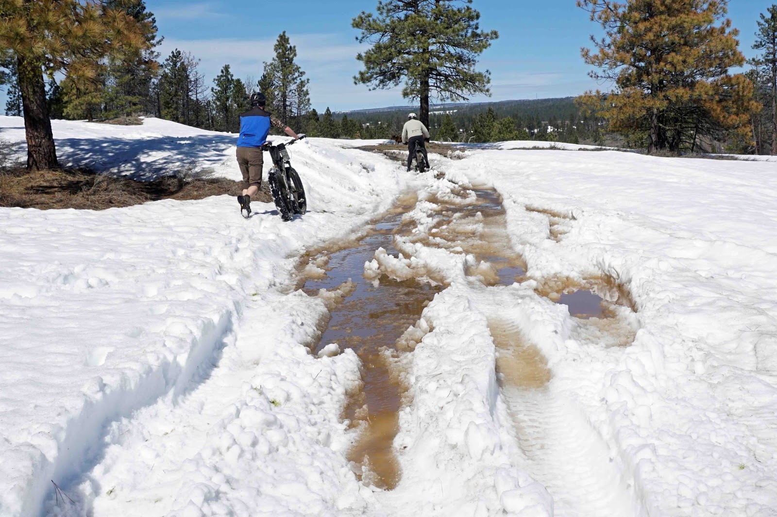
We decided that our first stop needed to be Towell Falls. Just a couple of miles into our journey, Chip remarked that he hadn't envisioned this kind of topography. What had been just on the tip of my tongue was that this garbage is steeper that shit. I responded instead that I hadn't envisioned this kind of topography, either. Culture truly can rub off.
 |
| Chip and Pat were on a tandem MTB, which can be extremely stressful to a relationship in this type of situation. Fortunately, they are pro's, and know when to dismount and maintain a little separation. |
It's the right time of year to check out Towell Falls, for sure. Rock Creek splits into two branches at this point, and there are three separate falls, two of which you can get to/see well, and one which is inaccessible and fairly hidden, but looks to be the most impressive of the three. Here's #1 . . .
And #2 . . .
Having satisfied our waterfall cravings, we set about on the return trip.
 |
| Chip and Pat, harmoniously rocking their rad tandem MTB up a climb. |
Once back at the parking area, we were ready to enter the ranch proper.
There's a lot of scenery to take in on the ranch . . .
I lost count of exactly how many cattle gates we went through, but it was approximately a shit-ton.
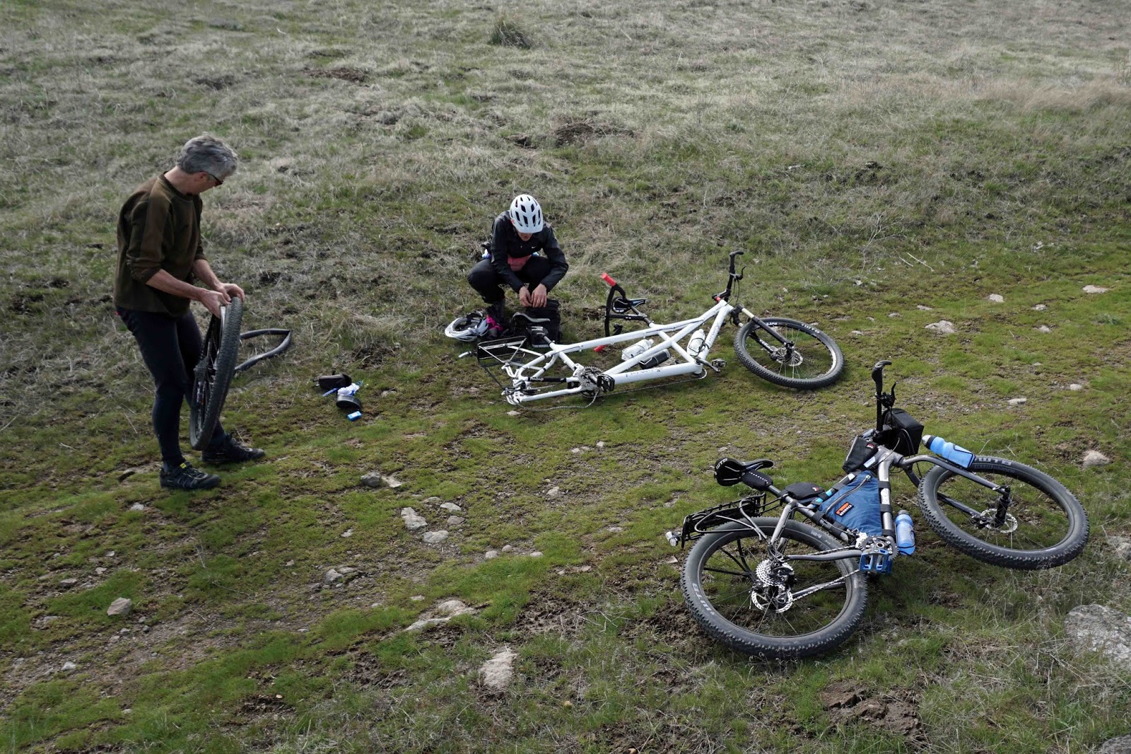
No serious adventure of this sort would be complete without an epic battle with goatheads, and so it would come to pass that we ran through a patch and punctured all four tires numerous times. I was sporting a tubeless setup on my sporty new wheels and tires, and the sealant did its job and I was largely unaffected. Chip had sealant in the tubes of both his front and rear tires, but the rear sealant had dried up and gave up the ghost under the attack.
Although Chip and I had both spent a bunch of time on Google maps/earth prior to our trip, and had both come pretty well prepared with gps machines loaded with tracks, our directional confidence began to falter as we got farther into the depths of the ranch. One thing that we could be pretty sure of was that Wall Lake was 1.25 miles ahead, in one direction or another. So we pressed on.
I am not quite sure why they call it Wall Lake. Also, it is either really cold there and icing the hell up, or those are mineral deposits, I am not quite sure. At any rate, the view was rather spectacular.
The water was not exactly alpine-lake-crystal-clear. More eastern-Washington-cow pasture-lowlands-you probably need to be really thirsty.
Captain Obvious has been busy placing markers.
The bulk of the cattle grazing population has not been transported in for the season, but there were still a few colorful characters hanging around.
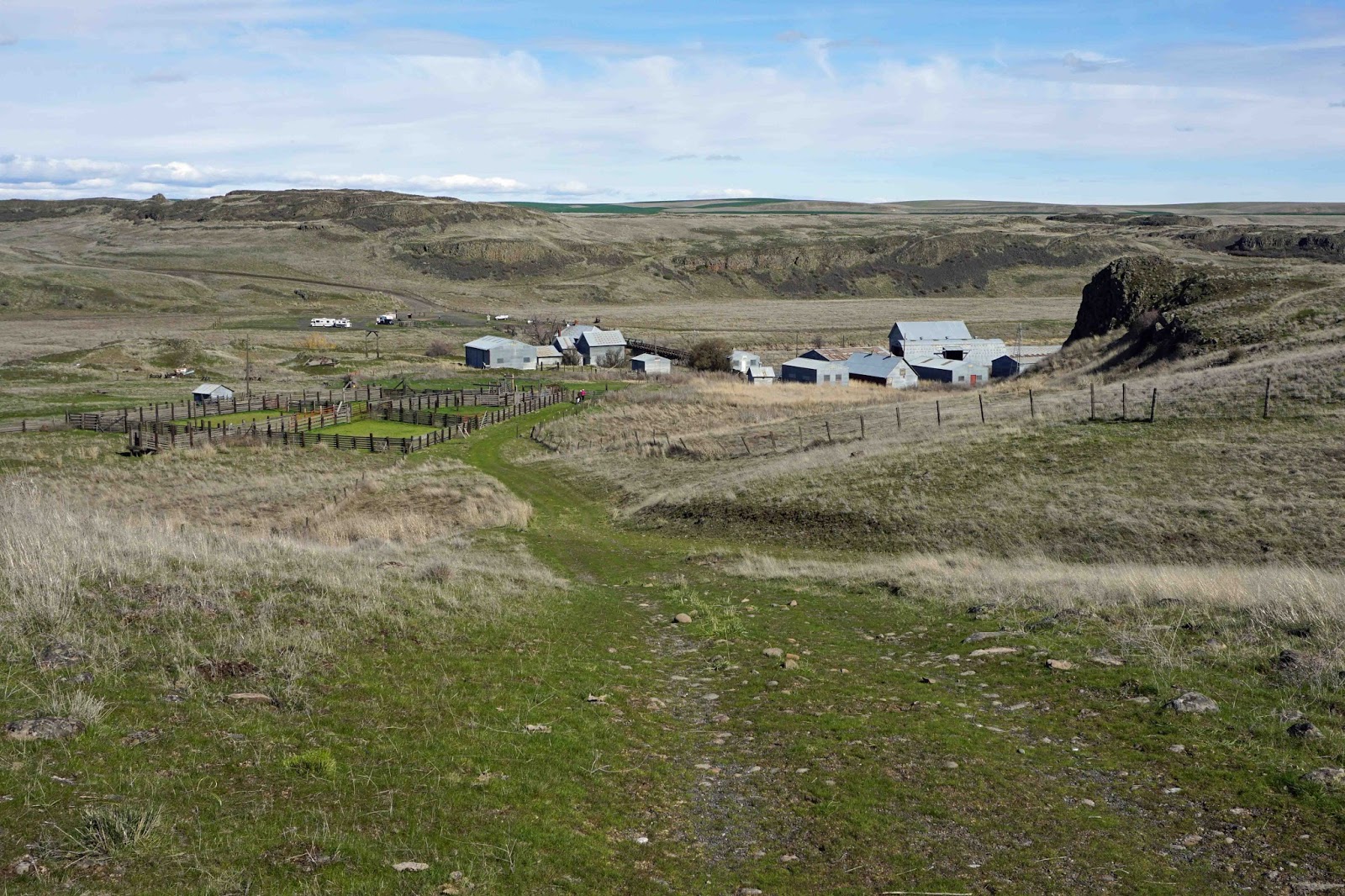
After a very nice loop through the ranch at the upper elevations, we descended back down to ranch headquarters and the parking area.
This is the ranch HQ, with the parking area just on the other side. Those vehicles in the distance on the left are equestrians and their animals and camping rigs, making a weekend of it.
Rock Creek/Escure Ranch is a pretty cool early-season rec area. We talked about the possibility of coming out for a weekend and base camping, and exploring in more depth. I would be super down with that.
John Wayne Pioneer Trail At Ewan
So here's the deal:
Chip has been following the drama surrounding
the attempted closure of 130 miles of the eastern portion of the JWPT for several months and he has some contacts in the know, and he told me that the landowner who owns a short section of the trail just SW of Ewan on Highway 23 has decided to close his section of trail to general use. It is not yet clear to me how he intends to enforce this closure, but if he succeeds in doing so, detour options will be necessary. We scouted out a couple of these today.
The first is the north detour. In the image below, the route from mile zero to the yellow diamond is the JWPT. The rest of what is shown is the detour. As you can see, the detour is only slightly longer than the section of detoured trail. The problem with this route, though, is that you will spend 3+ miles on the shoulder of Hwy 23, which is an armpit of a place to ride, IMO. It's just a major buzzkill in the middle of a remote, off-road journey through eastern WA. With that said, everyone has their own tastes and priorities, and this may not bother you that much.

The second detour option is to the south. Here again in the image below, the route from mile zero to the yellow diamond is the JWPT. The rest of what is shown is the detour. As you can see, the detour is about twice as long as the section of detoured trail. HOWEVER, the entire south detour route is gravel and also devoid of traffic. And what's even more significant is that the condition of the roads is generally pristine - very little in the way of washboards or loose gravel. If I were planning a JWPT trip today, it would be the south detour for me, hands down.
You can find more information on the north and south detour routes
here and
here, respectively.
I dig the variety and diversity of rugged and remote landscape that our fine state has to offer, and it was a real treat to get out and do some exploring today. I can only hope that this sets the tone for more of this type of activity this Spring and into Summer. Both my body and soul can use it.