I've been doing a lot of thinking about how the
Webb's Slough SON (SON = "Single Overnighter", credit Andre for the term) will work. It's pretty easy territory to just pass through quickly and get the hell out of on a fast road bike, but pretty crazy territory for planning to pack a bunch of gear to, watch an afternoon of boat racing and then spend the night in, logistically speaking.
But the geology and the town of St John and this insane event in the middle of farm country make it worth the extra effort. I hope. Could be a dumspter fire of a bike trip. But what's not to like about a good dumpster fire now and again?
Anyway, today was the day I'd set aside for some recon, by motor vehicle. It did happen and the following pics are from it. At this point, I'm confident that we have a good, solid, workable plan. There's definitely room to tweak and improve, but here's the basic layout:
Of the two race dates, Jun 18 and Aug 27, the Jun date makes way more sense: It's way greener and prettier and less parched, days are longer, and it's not in the middle of harvest, where you have to share the roads with farm equipment. Plus, I just feel that earlier is better. So that part's decided (executive decision).
Departure from Spo is somewhere in the 7-8 am range on Sat. Racing starts at 10, but goes pretty much all day, I think. (We don't need to see
every race.) It will take us maybe 5 hours to get there if we do some dirt, less if we stick to pavement. So arrive noon to one-ish. Watch. Absorb something extremely different. Drink a little beer, eat some concession food. Bake in the sun. Get our heads square with the concept of sprint boat racing.
Head out between 3 and 4. Hit the grocery store. From there, it's about a 12 mile ride to where we'll be spending the night. We've already ridden 50 loaded miles and then we've been cooking in the sun. One to 1.5 hours, so arrive at 5 or 5:30. Pitch camp, cook, eat, bullshit, pass out.
Early up next morning, all fired up about the 28 mile ride into Cheney on rollers. Breakfast at Willow Springs Station. Hopefully we tip better than we smell. Limp back into town on the FLT. Go home and
do yardwork nap the rest of the weekend.
You get the idea. Enough talk. Without further ado, here are the pictures.
 |
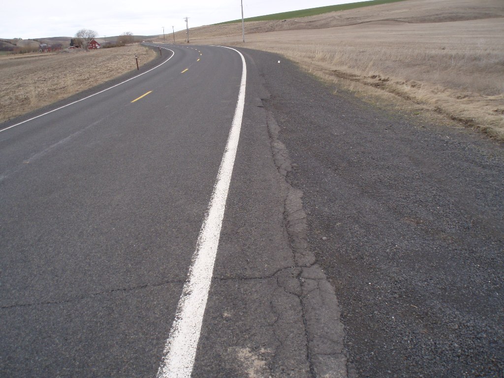
| 23 paved miles from the end of the FLT to Pine City on roads like these, except that it will be way greener and prettier. |
 |
| At Pine City we can either stay on paved and head straight to St John or peel of on dirt for the last 10. Yep, that's a primitive road sign. |
 |
| Not so primitve yet, just pretty. |
 |
| Getting more primitive. And climby. |
 |
| This pic is for Patty (RN at Shriner's). |
 |
| Our course is to the left. Now getting way more primitive. |
 |
| Just barely escaped the deadline. |
 |
| Very scenic. Erosion ruts are an avoidable nuisance. |
 |
| Very soft ground. Erosion ruts no longer avoidable. Picture doesn't do them justice, they were badass. Turned around (no small task). It was the right decision. I'm sure this will be all healed up by June. But bring your mad bunny hop skills, just in case. |
 |
| I went out to the slough, but couldn't get close enough to take a picture that meant anything. It's still there, trust me. Downtown St John, where we'll go to procure camp supplies after we leave the races. Two grocery stores, meaning twice as much of everything we need (beer). |
 |
| Cool storefront downtown. It's not a LBS, dont' be ridiculous. Looks like an office of a professional who happens to like bikes. |
 |
| The eight miles from St John to Ewan along Hwy 23 are the suckiest of the trip. Busy, 55 mph, no shoulder. We will persevere. |
 |
| From Ewan, we'll take Rock Lake Road north. Almost immediately, the John Wayne Trail (JWT) railbed is on display. Very cool. |
 |
| These next four pics are from Mike Sirott, taken last year on a venture of the area. He suggested that maybe we head up the JWT trail and camp here. It's a ways above the lake and so we'd have to pack water in, but how cool would it be to watch the sun go down from this vantage point. |
 |
| That's Lonnie. |
 |
| So bitchin. |
 |
| Thinking about pitching your tent in this tunnel? I'm way ahead of you. |
 |
| I took my bike along, hoping I could find the trailhead and ride far enough to find the cool camping spot. I found the trailhead. But the gate was locked. |
 |
| And it was obviously not cool to blow it off. |
 |
| I will be calling to find out if this is an option for us. |
 |
| Just a bit farther up the road is this access area to Rock Lake. |
 |
| I couldn't tell from the signs, so I asked someone there, and he said overnight camping is allowed. (I totally trust him because I liked his answer.) There are some decent spots, but I think we can cross the bridge, jump over a seriously sagging barbwire fence and get into some way radder camping territory. |
 |
| The amenities are righteous. |
 |
| Offset by the fact that no fires are allowed. Boo. We shall persevere, though. |
 |
| I thought I'd check out the dirt road options for getting back to Cheney. This one is on the NW side of the lake. The surface is sweet. Too bad it's so far away from the lake - the views are few and far between. |
 |
| But there are a few, and they're awesome. |
 |
| That's a JWT trestle, and a tunnel just to the right of it. Damn, so cool. |
 |
| The road eventually got primitiver and primitever. I didn't have the cajones to risk getting stuck in the middle of no-effing-where on a Sun afternoon, so I turned around, for the second time. |
 |
| One very cool visual on the trip back is this view of the road ahead. You can see almost four miles. And there's another visual treat on this leg of the journey, but I don't wanna ruin it for anyone who hasn't seen it. Better that you just round the corner and say "Whoa! What a trip!" |
At this point, I don't think you need me to tell you . . . You know you should do this trip. Don't you.


9 comments:
Awsome trip Pat. I'm interested to hear about the permit we're supposed to have to get onto the JWT. And if the permit allows camping, or if you assume it does.
Also I'm surprized you didn't see us riding south of Cheney yestarday. We were gonna do the CRL race course but cut it short on Cheney Plaza Rd when it started raining.
[Read with a lot of sarcasm] Oh, no! There are ruts in the road! There's muddy mud! And lock sure looks tough on that lake!
Why do you own an SUV if you don't use it? That's about as lame as signing off with an emoticon.
Alan :-P
Alright, my jab is WAY more effective if I spell check. Let's try this again:
[Read with a lot of sarcasm] Oh, no! There's ruts in the road! There's muddy mud too! And that lock sure looks tough on that gate!
:-P
June 18th. On the calendar. Dirt options look perfect to me.
Nice work Pat!
Already working on the scheduling... Wade
Mike, I tried getting through to someone at State Parks today but no luck. I'll let you know what I find out. I think I was out there a little later than you guys - got a late start. I did pass Stu as I was just heading out Cheney-Spangle (he was heading back toward Cheney). I read on the morning list that he was headed out at noon to do a loop of the CRL course, but it looks like he might have decided to bag it and turned around. Not much fun being out in 75 miles of wind and rain by yourself.
Alan, touche. ;-)
John and Wade, great to hear you're both on board.
My goodness I'd like to do this (even if you guys haven't met me).
Bryan, it would be great to have you along.
BLM use to handle permits east of river to Idaho state line, but now State parks handles to Lind I think? (no permit) but BLM east then. (permit yes)
Post a Comment